A new deep learning approach sharpens GNSS tomography into precise atmospheric maps, revealing storm-sensitive humidity patterns and offering meteorologists a powerful tool to predict extreme weather with greater accuracy and trust.

Research: High-resolution GNSS troposphere tomography through explainable deep learning-based downscaling framework. Image Credit: issaro prakalung / Shutterstock
For more than a century, weather forecasts have advanced from equations scribbled on chalkboards to today's powerful computer simulations. Yet even the most modern models still struggle with one critical gap: capturing small-scale phenomena such as heavy downpours, convection, or storm fronts. These fast-changing events demand high-resolution, reliable humidity data, but existing Global Navigation Satellite System (GNSS) tomography often produces smoothed images that blur out vital details. Downscaling techniques can sharpen resolution, but without trustworthy humidity inputs, the results remain unreliable. Based on these problems, scientists recognized the urgent need for a method that both refines GNSS data and preserves accuracy, opening the door to forecasts that can anticipate the weather's most dangerous twists.
A Breakthrough with Deep Learning and SRGAN
A team from the Wrocław University of Environmental and Life Sciences and collaborators has now taken on this challenge. In their paper published in the journal Satellite Navigation, they present the first deep learning framework capable of producing high-resolution GNSS tomography. By training a Super-Resolution Generative Adversarial Network (SRGAN) with weather model outputs, the researchers achieved unprecedented clarity in atmospheric maps. Tested in Poland and California, the system not only refined GNSS-derived humidity fields but also used explainable AI to make its reasoning visible.
Superior Accuracy and Interpretability
At the core of the work is a fusion of GNSS tomography and the Weather Research and Forecasting (WRF) model, with SRGAN acting as a translator between low-resolution and high-resolution images. In practical tests, the method delivered striking results. In Poland, error levels dropped by up to 62%, while in California, they fell by 52%, even under rainy conditions when humidity dynamics are most complex to capture. Compared with the widely used Lanczos3 interpolation method, SRGAN consistently produced sharper structures and finer gradients that better matched reference weather data and radiosonde measurements. What makes this advance especially compelling is the use of explainable AI tools, Grad-CAM and SHAP, that illuminated the regions the model emphasized. These visualizations revealed the AI's focus on storm-sensitive areas such as Poland's western frontiers and California's coastal mountain ranges. By proving both accuracy and interpretability, the study demonstrates how SRGAN can transform GNSS tomography from a blurred snapshot into a precise atmospheric map, paving the way for AI-enhanced meteorology.
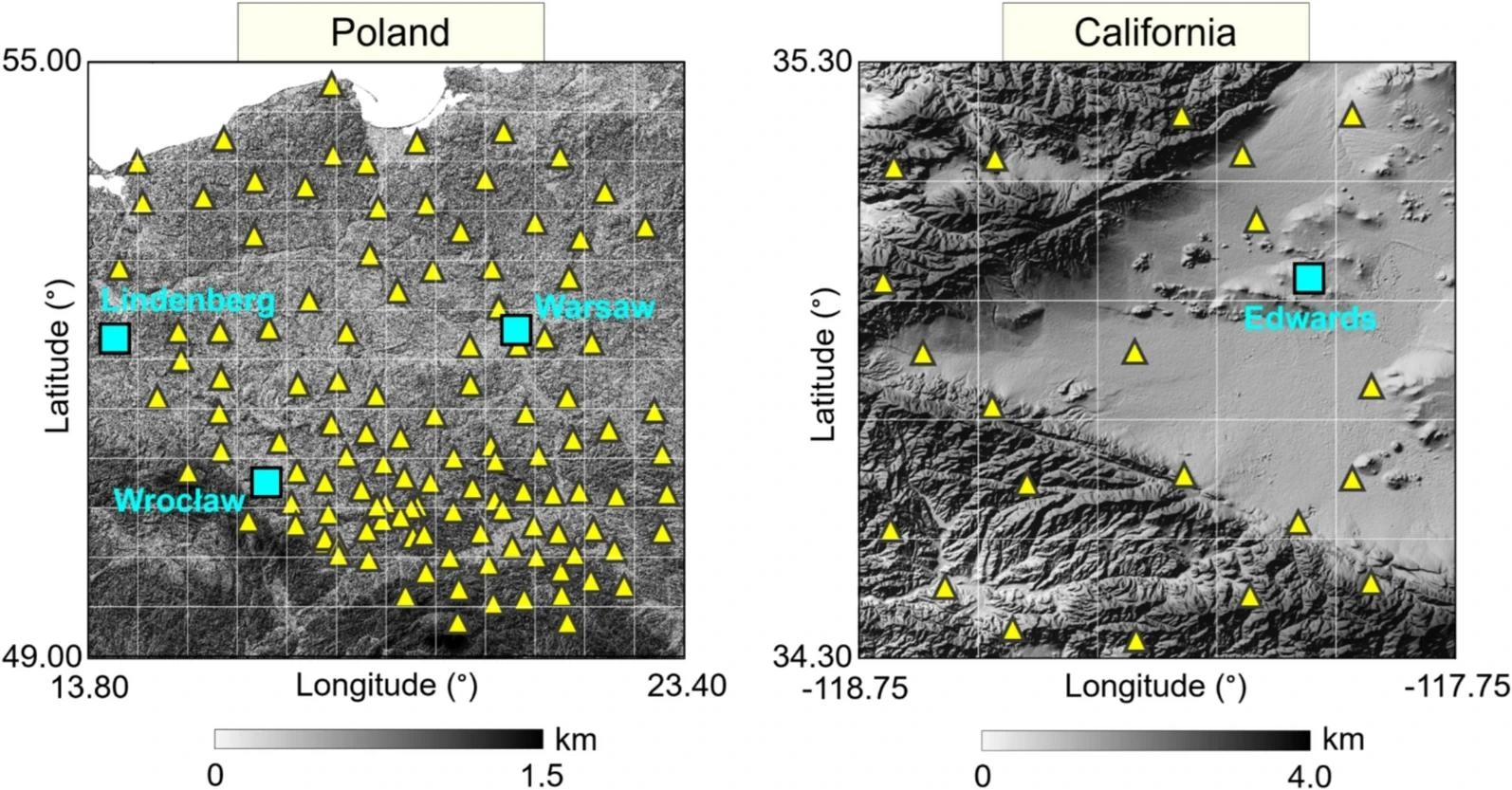
Spatial distribution of GNSS stations (triangles) and radiosonde stations (squares) on the topographic map of the study areas. White lines indicate the location of the tomography voxels
Impacts on Forecasting and Climate Resilience
"High-resolution atmospheric data is the missing link in forecasting the kind of weather that disrupts lives," said lead author Saeid Haji-Aghajany. "Our approach doesn't just sharpen GNSS tomography, it also shows us how the model makes its decisions. That transparency is critical for building trust as AI enters weather forecasting. By revealing the hidden details of storms and humidity patterns, we believe this method can give forecasters the tools they need to anticipate extreme events with greater confidence."
The implications of this breakthrough extend far beyond academic research. With sharper GNSS tomography, meteorologists can feed more accurate humidity fields into both physics-based and AI-driven forecasting models, significantly improving storm prediction and early warning systems. Communities vulnerable to flash floods, hurricanes, or sudden rainfall could benefit from faster, more reliable alerts. At the same time, the explainable AI framework ensures scientists can validate the system's reasoning, making it a trustworthy addition to forecasting pipelines. Looking ahead, this method could be integrated into global weather networks, strengthening resilience against the climate challenges of a rapidly changing world.
Source:
Journal reference:
 Hybrid AI Tool Boosts National Flood Forecast Accuracy